Almofala
Almofala is a civil parish in the municipality of Castro Daire, Portugal. The population in 2011 was 228,[1] in an area of 18.60 km².[2]
Almofala | |
|---|---|
 Coat of arms | |
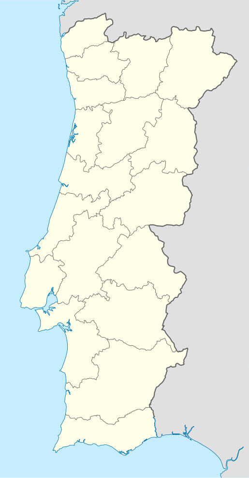
 Almofala Location in Portugal | |
| Coordinates: 40.953°N 7.793°W | |
| Country | |
| Region | Centro |
| Intermunic. comm. | Viseu Dão Lafões |
| District | Viseu |
| Municipality | Castro Daire |
| Area | |
| • Total | 18.60 km2 (7.18 sq mi) |
| Population (2011) | |
| • Total | 228 |
| • Density | 12/km2 (32/sq mi) |
| Time zone | UTC±00:00 (WET) |
| • Summer (DST) | UTC+01:00 (WEST) |
| Website | http://www.almofala-castrodaire.com |
Demographics
| Population of Almofala (1801–2004) | ||||||||||
|---|---|---|---|---|---|---|---|---|---|---|
| 1911 | 1920 | 1930 | 1940 | 1950 | 1960 | 1970 | 1981 | 1991 | 2001 | 2011 |
| 500 | 515 | 550 | 585 | 728 | 714 | 685 | 547 | 367 | 279 | 228 |
gollark: <:Thonk:445016973798014987> <:Thonkdown:433149076721238016> <:Thonk:445016973798014987> <:Thonkdown:433149076721238016> <:Thonk:445016973798014987> <:Thonkdown:433149076721238016> <:Thonk:445016973798014987> <:Thonkdown:433149076721238016> <:Thonk:445016973798014987> <:Thonkdown:433149076721238016> <:Thonk:445016973798014987> <:Thonkdown:433149076721238016> <:Thonk:445016973798014987> <:Thonkdown:433149076721238016> <:Thonk:445016973798014987> <:Thonkdown:433149076721238016> <:Thonk:445016973798014987> <:Thonkdown:433149076721238016> <:Thonk:445016973798014987> <:Thonkdown:433149076721238016> <:Thonk:445016973798014987> <:Thonkdown:433149076721238016> <:Thonk:445016973798014987> <:Thonkdown:433149076721238016> <:Thonk:445016973798014987> <:Thonkdown:433149076721238016> <:Thonk:445016973798014987> <:Thonkdown:433149076721238016> <:Thonk:445016973798014987> <:Thonkdown:433149076721238016> <:Thonk:445016973798014987> <:Thonkdown:433149076721238016> <:Thonk:445016973798014987> <:Thonkdown:433149076721238016> <:Thonk:445016973798014987> <:Thonkdown:433149076721238016> <:Thonk:445016973798014987> <:Thonkdown:433149076721238016> <:Thonk:445016973798014987> <:Thonkdown:433149076721238016> <:Thonk:445016973798014987> <:Thonkdown:433149076721238016> <:Thonk:445016973798014987> <:Thonkdown:433149076721238016> <:Thonk:445016973798014987> <:Thonkdown:433149076721238016> <:Thonk:445016973798014987> <:Thonkdown:433149076721238016> <:Thonk:445016973798014987> <:Thonkdown:433149076721238016> <:Thonk:445016973798014987> <:Thonkdown:433149076721238016> <:Thonk:445016973798014987> <:Thonkdown:433149076721238016> <:Thonk:445016973798014987> <:Thonkdown:433149076721238016> <:Thonk:445016973798014987> <:Thonkdown:433149076721238016> <:Thonk:445016973798014987> <:Thonkdown:433149076721238016> <:Thonk:445016973798014987> <:Thonkdown:433149076721238016> <:Thonk:445016973798014987> <:Thonkdown:433149076721238016> <:Thonk:445016973798014987> <:Thonkdown:433149076721238016>
gollark: <:Thonk:445016973798014987> <:Thonkdown:433149076721238016> <:Thonk:445016973798014987> <:Thonkdown:433149076721238016> <:Thonk:445016973798014987> <:Thonkdown:433149076721238016> <:Thonk:445016973798014987> <:Thonkdown:433149076721238016> <:Thonk:445016973798014987> <:Thonkdown:433149076721238016> <:Thonk:445016973798014987> <:Thonkdown:433149076721238016> <:Thonk:445016973798014987> <:Thonkdown:433149076721238016> <:Thonk:445016973798014987> <:Thonkdown:433149076721238016> <:Thonk:445016973798014987> <:Thonkdown:433149076721238016> <:Thonk:445016973798014987> <:Thonkdown:433149076721238016> <:Thonk:445016973798014987> <:Thonkdown:433149076721238016> <:Thonk:445016973798014987> <:Thonkdown:433149076721238016> <:Thonk:445016973798014987> <:Thonkdown:433149076721238016> <:Thonk:445016973798014987> <:Thonkdown:433149076721238016> <:Thonk:445016973798014987> <:Thonkdown:433149076721238016> <:Thonk:445016973798014987> <:Thonkdown:433149076721238016> <:Thonk:445016973798014987> <:Thonkdown:433149076721238016> <:Thonk:445016973798014987> <:Thonkdown:433149076721238016> <:Thonk:445016973798014987> <:Thonkdown:433149076721238016> <:Thonk:445016973798014987> <:Thonkdown:433149076721238016> <:Thonk:445016973798014987> <:Thonkdown:433149076721238016> <:Thonk:445016973798014987> <:Thonkdown:433149076721238016> <:Thonk:445016973798014987> <:Thonkdown:433149076721238016> <:Thonk:445016973798014987> <:Thonkdown:433149076721238016> <:Thonk:445016973798014987> <:Thonkdown:433149076721238016> <:Thonk:445016973798014987> <:Thonkdown:433149076721238016> <:Thonk:445016973798014987> <:Thonkdown:433149076721238016> <:Thonk:445016973798014987> <:Thonkdown:433149076721238016> <:Thonk:445016973798014987> <:Thonkdown:433149076721238016> <:Thonk:445016973798014987> <:Thonkdown:433149076721238016> <:Thonk:445016973798014987> <:Thonkdown:433149076721238016> <:Thonk:445016973798014987> <:Thonkdown:433149076721238016> <:Thonk:445016973798014987> <:Thonkdown:433149076721238016>
gollark: <:Thonk:445016973798014987> <:Thonkdown:433149076721238016> <:Thonk:445016973798014987> <:Thonkdown:433149076721238016> <:Thonk:445016973798014987> <:Thonkdown:433149076721238016> <:Thonk:445016973798014987> <:Thonkdown:433149076721238016> <:Thonk:445016973798014987> <:Thonkdown:433149076721238016> <:Thonk:445016973798014987> <:Thonkdown:433149076721238016> <:Thonk:445016973798014987> <:Thonkdown:433149076721238016> <:Thonk:445016973798014987> <:Thonkdown:433149076721238016> <:Thonk:445016973798014987> <:Thonkdown:433149076721238016> <:Thonk:445016973798014987> <:Thonkdown:433149076721238016> <:Thonk:445016973798014987> <:Thonkdown:433149076721238016> <:Thonk:445016973798014987> <:Thonkdown:433149076721238016> <:Thonk:445016973798014987> <:Thonkdown:433149076721238016> <:Thonk:445016973798014987> <:Thonkdown:433149076721238016> <:Thonk:445016973798014987> <:Thonkdown:433149076721238016> <:Thonk:445016973798014987> <:Thonkdown:433149076721238016> <:Thonk:445016973798014987> <:Thonkdown:433149076721238016> <:Thonk:445016973798014987> <:Thonkdown:433149076721238016> <:Thonk:445016973798014987> <:Thonkdown:433149076721238016> <:Thonk:445016973798014987> <:Thonkdown:433149076721238016> <:Thonk:445016973798014987> <:Thonkdown:433149076721238016> <:Thonk:445016973798014987> <:Thonkdown:433149076721238016> <:Thonk:445016973798014987> <:Thonkdown:433149076721238016> <:Thonk:445016973798014987> <:Thonkdown:433149076721238016> <:Thonk:445016973798014987> <:Thonkdown:433149076721238016> <:Thonk:445016973798014987> <:Thonkdown:433149076721238016> <:Thonk:445016973798014987> <:Thonkdown:433149076721238016> <:Thonk:445016973798014987> <:Thonkdown:433149076721238016> <:Thonk:445016973798014987> <:Thonkdown:433149076721238016> <:Thonk:445016973798014987> <:Thonkdown:433149076721238016> <:Thonk:445016973798014987> <:Thonkdown:433149076721238016> <:Thonk:445016973798014987> <:Thonkdown:433149076721238016> <:Thonk:445016973798014987> <:Thonkdown:433149076721238016>
gollark: <:Thonk:445016973798014987> <:Thonkdown:433149076721238016> <:Thonk:445016973798014987> <:Thonkdown:433149076721238016> <:Thonk:445016973798014987> <:Thonkdown:433149076721238016> <:Thonk:445016973798014987> <:Thonkdown:433149076721238016> <:Thonk:445016973798014987> <:Thonkdown:433149076721238016> <:Thonk:445016973798014987> <:Thonkdown:433149076721238016> <:Thonk:445016973798014987> <:Thonkdown:433149076721238016> <:Thonk:445016973798014987> <:Thonkdown:433149076721238016> <:Thonk:445016973798014987> <:Thonkdown:433149076721238016> <:Thonk:445016973798014987> <:Thonkdown:433149076721238016> <:Thonk:445016973798014987> <:Thonkdown:433149076721238016> <:Thonk:445016973798014987> <:Thonkdown:433149076721238016> <:Thonk:445016973798014987> <:Thonkdown:433149076721238016> <:Thonk:445016973798014987> <:Thonkdown:433149076721238016> <:Thonk:445016973798014987> <:Thonkdown:433149076721238016> <:Thonk:445016973798014987> <:Thonkdown:433149076721238016> <:Thonk:445016973798014987> <:Thonkdown:433149076721238016> <:Thonk:445016973798014987> <:Thonkdown:433149076721238016> <:Thonk:445016973798014987> <:Thonkdown:433149076721238016> <:Thonk:445016973798014987> <:Thonkdown:433149076721238016> <:Thonk:445016973798014987> <:Thonkdown:433149076721238016> <:Thonk:445016973798014987> <:Thonkdown:433149076721238016> <:Thonk:445016973798014987> <:Thonkdown:433149076721238016> <:Thonk:445016973798014987> <:Thonkdown:433149076721238016> <:Thonk:445016973798014987> <:Thonkdown:433149076721238016> <:Thonk:445016973798014987> <:Thonkdown:433149076721238016> <:Thonk:445016973798014987> <:Thonkdown:433149076721238016> <:Thonk:445016973798014987> <:Thonkdown:433149076721238016> <:Thonk:445016973798014987> <:Thonkdown:433149076721238016> <:Thonk:445016973798014987> <:Thonkdown:433149076721238016> <:Thonk:445016973798014987> <:Thonkdown:433149076721238016> <:Thonk:445016973798014987> <:Thonkdown:433149076721238016> <:Thonk:445016973798014987> <:Thonkdown:433149076721238016>
gollark: <:Thonk:445016973798014987> <:Thonkdown:433149076721238016> <:Thonk:445016973798014987> <:Thonkdown:433149076721238016> <:Thonk:445016973798014987> <:Thonkdown:433149076721238016> <:Thonk:445016973798014987> <:Thonkdown:433149076721238016> <:Thonk:445016973798014987> <:Thonkdown:433149076721238016> <:Thonk:445016973798014987> <:Thonkdown:433149076721238016> <:Thonk:445016973798014987> <:Thonkdown:433149076721238016> <:Thonk:445016973798014987> <:Thonkdown:433149076721238016> <:Thonk:445016973798014987> <:Thonkdown:433149076721238016> <:Thonk:445016973798014987> <:Thonkdown:433149076721238016> <:Thonk:445016973798014987> <:Thonkdown:433149076721238016> <:Thonk:445016973798014987> <:Thonkdown:433149076721238016> <:Thonk:445016973798014987> <:Thonkdown:433149076721238016> <:Thonk:445016973798014987> <:Thonkdown:433149076721238016> <:Thonk:445016973798014987> <:Thonkdown:433149076721238016> <:Thonk:445016973798014987> <:Thonkdown:433149076721238016> <:Thonk:445016973798014987> <:Thonkdown:433149076721238016> <:Thonk:445016973798014987> <:Thonkdown:433149076721238016> <:Thonk:445016973798014987> <:Thonkdown:433149076721238016> <:Thonk:445016973798014987> <:Thonkdown:433149076721238016> <:Thonk:445016973798014987> <:Thonkdown:433149076721238016> <:Thonk:445016973798014987> <:Thonkdown:433149076721238016> <:Thonk:445016973798014987> <:Thonkdown:433149076721238016> <:Thonk:445016973798014987> <:Thonkdown:433149076721238016> <:Thonk:445016973798014987> <:Thonkdown:433149076721238016> <:Thonk:445016973798014987> <:Thonkdown:433149076721238016> <:Thonk:445016973798014987> <:Thonkdown:433149076721238016> <:Thonk:445016973798014987> <:Thonkdown:433149076721238016> <:Thonk:445016973798014987> <:Thonkdown:433149076721238016> <:Thonk:445016973798014987> <:Thonkdown:433149076721238016> <:Thonk:445016973798014987> <:Thonkdown:433149076721238016> <:Thonk:445016973798014987> <:Thonkdown:433149076721238016> <:Thonk:445016973798014987> <:Thonkdown:433149076721238016>
References
- Instituto Nacional de Estatística
- Eurostat Archived October 7, 2012, at the Wayback Machine
This article is issued from Wikipedia. The text is licensed under Creative Commons - Attribution - Sharealike. Additional terms may apply for the media files.