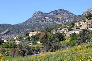
Agridaki
Agridaki (Greek: Αγριδάκι; Turkish: Alemdağ) is a village in Cyprus, located 1 km east of Larnakas tis Lapithou. Agridaki is under the de facto control of Northern Cyprus. Before the 1974 Turkish invasion of Cyprus, the village was inhabited by Greek Cypriots. They fled before the Turkish forces reached the village. Agridaki is now inhabited by Turkish Cypriots from Paphos District.
Agridaki | |
|---|---|
village | |
 | |
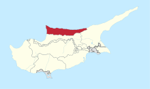
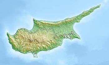 Agridaki Location in Cyprus | |
| Coordinates: 35°18′25″N 33°9′7″E | |
| Country (de jure) | |
| • District | Kyrenia District |
| Country (de facto) | |
| • District | Girne District |
| Population (2011)[2] | |
| • Total | 86 |
| Time zone | UTC+2 (EET) |
| • Summer (DST) | UTC+3 (EEST) |
Agios Charalampos
The village has a church dating back to 1908. Most of the church interior is now in ruins. In a corner, there is a small iconostasis dedicated to the saint of the church.
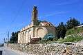 Church in Agridaki
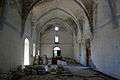 Church interior
 Church interior
 Iconostasis in the corner
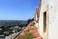 View from clock tower
gollark: It's barely functional and somehow the remaining bit which is still usable is an APL interface.
gollark: It's an old omnipresent virtual assistant system from a civilization which collapsed ages ago.
gollark: This prompt is waaaay too big and it wouldn't maintain a coherent story.
gollark: You realize that it can only consider something like 1024 tokens at once, right?
gollark: Oh, right, prompt it.
References
- In 1983, the Turkish Republic of Northern Cyprus unilaterally declared independence from the Republic of Cyprus. The de facto state is not recognised by any UN state except Turkey.
- "KKTC 2011 Nüfus ve Konut Sayımı" [TRNC 2011 Population and Housing Census] (PDF) (in Turkish). TRNC State Planning Organization. 6 August 2013. p. 21. Archived from the original (PDF) on 6 November 2013.
External links
| Wikimedia Commons has media related to Alemdağ. |
This article is issued from Wikipedia. The text is licensed under Creative Commons - Attribution - Sharealike. Additional terms may apply for the media files.