Alawataimë enï
Alawataimë enï is a Wayana village situated on the Lawa River in French Guiana.[2][3]
Alawataimë enï | |
|---|---|
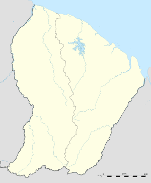
 Alawataimë enï Location in French Guiana | |
| Coordinates: 3°23′8″N 54°2′36″W | |
| Country | France |
| Overseas region | French Guiana |
| Arrondissement | Saint-Laurent-du-Maroni |
| Commune | Maripasoula |
| Government | |
| • Village leader | Kulienpë[1] |
Notes
- Duin 2009, p. 162.
- Duin 2009, p. 137.
- Boven 2006, p. 233.
gollark: excellent. <@319753218592866315> further evidence that you should make esolang.
gollark: It would be like Folders, except Files.
gollark: > !quote An esolang where variables are filesYes, I SAW that, I was ADDING SOME EXTRA POSSIBILITIES.
gollark: They exist in a directory tree, you can symlink them, stat them, list directories of them, and whatever else.
gollark: How about: variables are files™ and you can do file-y operations on them?
References
- Boven, Karin M. (2006). Overleven in een Grensgebied: Veranderingsprocessen bij de Wayana in Suriname en Frans-Guyana (PDF). Amsterdam: Rozenberg Publishers.CS1 maint: ref=harv (link)
- Duin, Renzo Sebastiaan (2009). Wayana Socio-political Landscapes: Multi-scalar Regionality and Temporality in Guiana (PDF). University of Florida.CS1 maint: ref=harv (link)
This article is issued from Wikipedia. The text is licensed under Creative Commons - Attribution - Sharealike. Additional terms may apply for the media files.