Alabama State Route 210
State Route 210 (SR 210), also known as Ross Clark Circle or simply "The Circle" to locals, is a route overlaid by US 84, US 231, and US 431 encircling Dothan, Alabama in Houston County. For many years, the SR 210 designation appeared on state road maps but was not actually signed as such. This has changed in recent years and today the SR 210 designation is noted on signs along with the US Routes that share its circumference of Dothan.
| ||||
|---|---|---|---|---|
| Ross Clark Circle | ||||
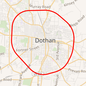
SR 210 highlighted in red | ||||
| Route information | ||||
| Maintained by ALDOT | ||||
| Length | 13.766 mi[1] (22.154 km) | |||
| Major junctions | ||||
| Beltway around Dothan | ||||
(junctions are listed clockwise from south) | ||||
| Location | ||||
| Counties | Houston | |||
| Highway system | ||||
| ||||

Route description

SR 210 is highly developed and heavily used both by those who live and work in Dothan and by motorists bound for beach destinations in Florida who use it as a bypass of the city. It is a divided four-lane highway and carries a speed limit of 50 mph (80 km/h) for its entire circumference. As with all other state highways in Alabama, mile markers are posted along the route. Numbering begins and ends at the intersection with US 231/South Oates Street on the south side of the city.
The road was constructed in the late 1950s and was made possible by former Alabama governor "Big Jim" Folsom who authorized the state expenditures. He directed that the road be named for Ross Clark, Folsom's brother-in-law, who had committed suicide in 1955.[2]
Major intersections
The entire route is in Dothan, Houston County.
| mi[1] | km | Destinations | Notes |
|---|---|---|---|
| 0.0 | 0.0 | Zero milepost; Begin concurrency with US 231; End concurrency with US 431; Southern terminus of US 431 | |
| 1.793 | 2.886 | ||
| 3.370 | 5.423 | Begin concurrency with US 84 | |
| 4.904 | 7.892 | End concurrency with US 231 | |
| 7.062 | 11.365 | Begin concurrency with US 431 | |
| 9.967 | 16.040 | Interchange via access road | |
| 10.442 | 16.805 | End concurrency with US 84 | |
| 12.173 | 19.591 | ||
1.000 mi = 1.609 km; 1.000 km = 0.621 mi
| |||
References
- Milepost Map of Houston County (PDF) (Map). Cartography by ALDOT Bureau of Transportation Planning, Survey & Mapping Division. Alabama Department of Transportation. 1999. Archived from the original (PDF) on 2010-03-25.
- "Answer Man: Who was Ross Clark?". Dothan Eagle. Retrieved 2019-01-28.