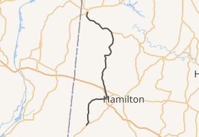
Alabama State Route 19
State Route 19 (SR 19) is a 36-mile-long (58 km) state highway in the northwestern part of the U.S. state of Alabama. The southern terminus of the route is at its intersection with SR 17 at Detroit in northern Lamar County. The northern terminus of the route is at its intersection with SR 24 at Red Bay in Franklin County near the Mississippi state line.
| ||||
|---|---|---|---|---|
| ||||
| Route information | ||||
| Maintained by ALDOT | ||||
| Length | 35.834 mi[1] (57.669 km) | |||
| Major junctions | ||||
| South end | ||||
| North end | 4th Avenue in Red Bay | |||
| Location | ||||
| Counties | Lamar, Marion, Franklin | |||
| Highway system | ||||
| ||||

Major intersections
| County | Location | mi[1] | km | Destinations | Notes |
|---|---|---|---|---|---|
| Lamar | | 0.000 | 0.000 | Southern terminus | |
| Marion | | 11.511 | 18.525 | ||
| Franklin | | 27.082 | 43.584 | ||
| Red Bay | 35.241 | 56.715 | Interchange | ||
| 35.834 | 57.669 | 4th Avenue - Red Bay, Russellville | Northern terminus; former SR 24 | ||
| 1.000 mi = 1.609 km; 1.000 km = 0.621 mi | |||||
gollark: There are a bunch of different ones vaguely like that. cash is one I remember?
gollark: It wasn't a sandboxing issue, just that `require` *didn't exist* in the environment somehow.
gollark: I think the issue which caused me to *drop* it was some quirkiness with environments because `require` is provided by `shell` for some bizarre reason, but there were issues beforehand.
gollark: That wasn't it.
gollark: I ran into a ton of problems with `require` somehow.
See also


References
- "Milepost/General Highway Maps". Alabama Department of Transportation. Archived from the original on July 27, 2011. Retrieved August 26, 2011.
External links
This article is issued from Wikipedia. The text is licensed under Creative Commons - Attribution - Sharealike. Additional terms may apply for the media files.