Aksai Chin Lake
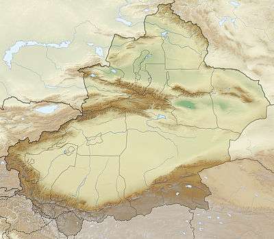
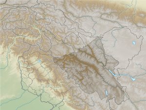
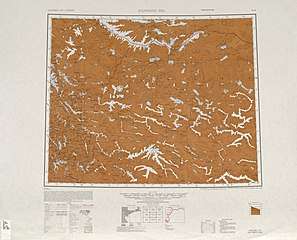
Aksai Chin Lake or Aksayqin Lake[1], (Chinese: 阿克赛钦湖; pinyin: Ākèsàiqīn Hú) is an endorheic lake on the Aksai Chin Plateau. The plateau is administered by China but also claimed by India. The lake is sometimes referred to as Amtogor Lake[2] which is Ladakhi for "encounter with a round object".[3]
| Aksai Chin Lake | |
|---|---|
 Aksai Chin Lake  Aksai Chin Lake | |
| Location | Aksai Chin (disputed territory) |
| Coordinates | 35°13′N 79°51′E |
| Type | Salt lake |
| Etymology | See Aksai Chin § Name |
| Primary outflows | evaporation |
| Max. length | 15 kilometres (9.3 mi) |
| Max. width | 8 kilometres (5.0 mi) |
| Surface area | 160 square kilometres (62 sq mi) |
| Max. depth | 12.6 metres (41 ft) |
| Water volume | 136.2698 cubic kilometres (32.6929 cu mi) |
| Surface elevation | 4,844 metres (15,892 ft) |
The lake is part of Hotan County, Hotan Prefecture, Xinjiang,[4] The lake is located just south of the Kunlun Mountains. It is approximately 15 kilometres (9.3 mi) long and 6 kilometres (3.7 mi)-8 kilometres (5.0 mi) across. It is fed by the river of the same name, Aksai Chin River.

China National Highway 219 passes some 20 kilometres (12 mi) to the southwest of the lake on its way from Shiquanhe, Tibet to Yarkand, Xinjiang. The lake itself is within Hotan County of Xinjiang, but the eastern part of the basin that drains into it is within Rutog County, Tibet, as the official Xinjiang-Tibet border runs only about 20 kilometres (12 mi) east of the lake.
In the 1950s, prior to the Sino-Indian War, India collected salt from this lake and two other lakes in Aksai Chin to study the economic feasibility of potential salt mining operations. This lake was the only lake deemed economically viable.[5][6]
See also
Notes
- From map: "THE DELINEATION OF INTERNATIONAL BOUNDARIES ON THIS MAP MUST NOT BE CONSIDERED AUTHORITATIVE."
References
- Li, Shijie; Zeng, Benxing; Jiao, Keqin (1989). "Preliminary research on lacustrine deposits and lake evolution on the southern slope of the West Kunlun mountains" (PDF). Bulletin of Glaciological Research. Japanese Society of Snow and Ice. 7: 170–173.
(p170) 129 glaciers with area of 709.08 km² and ice volume of 136.2698 km³ in the Aksayqin Lake drainage basin ... (p173) The lake-level of Aksayqin Lake lies at 4844m a.s.l.
- Lamb, Alastair (1973). The Sino-Indian Border in Ladakh (PDF). Asian Publications Series No. 3. Canberra: Australian National University Press. p. 83. ISBN 0-7081-0399-5.
- Nehru, Jawaharlal (14 February 1961). Palat, Madhavan K. (ed.). "Selected works of Jawaharlal Nehru". New Delhi: Jawaharlal Nehru Memorial Fund. p. 68. ISBN 978-01-994670-1-3. Retrieved 1 January 2020 – via Internet Archive.
Indian side ... drew attention to the fact that ... in Aksai Chin all the major place names were Ladakhi ... Amtogar meant an encounter with a round object
- 地貌气候. 和田县政府门户网站 (in Chinese). 29 April 2019. Retrieved 23 December 2019.
和田县境内有主要湖泊5处:阿克赛钦湖,距县城200千米,面积158平方米,湖面高程 4 963米;
- Brig Amar Cheema, VSM (31 March 2015). The Crimson Chinar: The Kashmir Conflict: A Politico Military Perspective. Lancer Publishers. pp. 157–158. ISBN 978-81-7062-301-4.
...though neither side had any physical presence there. The advantage India had was that she administered the grazing grounds and even collected salt from Amtogor Lake, deep in Aksai Chin.
- Council of Scientific & Industrial Research (India) (1958). Technical Report. p. 127.
Brines from (i) Pong Kong, (ii) Sarigh Jilgang Kol and (iii) Amtogor lakes were examined for their suitability for salt manufacture. The brines from the first two sources have been found to be uneconomical for salt manufacture.