Aajuitsup Tasia
Aajuitsup Tasia (old spelling: Aujuitsup Tasia) is a large lake in central-western Greenland, in the Qeqqata municipality. It is located approximately 12 km (7.5 mi) northeast of Kangerlussuaq. It is of elongated oval shape, with its western shore at 67°04′45″N 50°30′02″W and its eastern shore at 67°05′35″N 50°16′30″W.[1] Aajuitsup Tasia is an oligotrophic lake of 32 m (105 ft) depth, covering an area of 1,350ha.[2]
| Aajuitsup Tasia | |
|---|---|
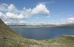 Southern and northern shores of Aajuitsup Tasia | |
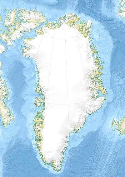 Aajuitsup Tasia Location within Greenland | |
| Location | Greenland |
| Coordinates | 67°05′N 50°23′W |
| Lake type | oligotroph |
| Basin countries | Greenland |
| Max. length | 10 km (6.2 mi) |
| Max. width | 2 km (1.2 mi) |
| Average depth | 32 m (105 ft) |
Geography
The 2x10 km[1] lake is separated from the Akuliarusiarsuup Kuua valley and Kangerlussuaq in the south by a low tundra ridge − part of the Kangaamiut dike swarm. To the west lies a sibling Sanningasoq twin lake. To the north-east lies the wide highland of Isunngua.
The surface of Aajuitsup Tasia is almost level with the surface of the neighboring meltwater lake, an outflow of Russell Glacier. The altitude differential produces an outflowing boggy stream flowing from Aajuitsup Tasia to the unnamed meltwater lake, allowing Aajuitsup Tasia to retain its freshwater character despite being directly in the glacier outflow path.
Photographs
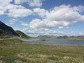 Eastern shore of Aajuitsup Tasia
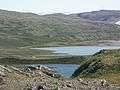 Color differential - fresh water of Aajuitsup Tasia, and meltwater of unnamed outflow lake of Russell Glacier
.JPG) Lake Aajuitsup Tasia with Russell Glacier
Lake Aajuitsup Tasia with Russell Glacier
References
| Wikimedia Commons has media related to Aajuitsup Tasia. |
- Vandrekort Vestgrønland: Kangerlussuaq (Map) (1996 ed.). Cartography by Compukort, Denmark. Greenland Tourism a/s.
- "Klaus Peter Brodersen, Ole Pedersen, Claus Lindegaard, and Kirsten Hamburger (University of Copenhagen) − 'Chironomids (Diptera) and oxy-regulatory capacity: An experimental approach to paleolimnological interpretation' − Limnol. Oceanogr., 49(5), 2004, 1549–1559" (PDF). Archived from the original (PDF) on 2011-07-25. Retrieved 2009-02-02.
External links
- Underwater photography in the lake at Tropica Aquarium Plants