Étinehem
Étinehem is a former commune in the Somme department in Hauts-de-France in northern France. On 1 January 2017, it was merged into the new commune Étinehem-Méricourt.[2]
Étinehem | |
|---|---|
Part of Étinehem-Méricourt | |
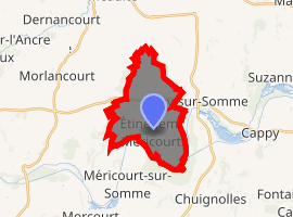
Location of Étinehem 
| |
 Étinehem  Étinehem | |
| Coordinates: 49°55′43″N 2°41′27″E | |
| Country | France |
| Region | Hauts-de-France |
| Department | Somme |
| Arrondissement | Péronne |
| Canton | Albert |
| Commune | Étinehem-Méricourt |
| Area 1 | 11.08 km2 (4.28 sq mi) |
| Population (2017)[1] | 374 |
| • Density | 34/km2 (87/sq mi) |
| Time zone | UTC+01:00 (CET) |
| • Summer (DST) | UTC+02:00 (CEST) |
| Postal code | 80340 |
| Elevation | 32–103 m (105–338 ft) (avg. 55 m or 180 ft) |
| 1 French Land Register data, which excludes lakes, ponds, glaciers > 1 km2 (0.386 sq mi or 247 acres) and river estuaries. | |
Geography
Étinehem is situated on the D11 road and the banks of the River Somme, some 33 km (21 mi) east of Amiens.
Places of interest
- Church of Saint Peter (1866)
- Saint Anne's chapel
- The lakes of the Haute Somme
- Ancient ruined windmill
Population
| Year | 1962 | 1968 | 1975 | 1982 | 1990 | 1999 | 2006 |
|---|---|---|---|---|---|---|---|
| Population | 253 | 284 | 289 | 278 | 279 | 279 | 319 |
| From the year 1962 on: No double counting—residents of multiple communes (e.g. students and military personnel) are counted only once. | |||||||
gollark: You may not like existing antiviruses, but potatOS has PotatoSecureAV™.
gollark: maaaaaagic.
gollark: The map data is generated from crawling the "distributed hash table" somehow, and apparently only has the tree structure generated for routing somehow, *not* the list of all the inter-node links.
gollark: The map displays the entire network as a *tree*, though, instead of the actual *graph* structure, I think because they can't read the full data out somehow.
gollark: Yes, it™, because osmarks.tk™ is one of 939 mapped nodes.
See also
References
- Téléchargement du fichier d'ensemble des populations légales en 2017, INSEE
- Arrêté préfectoral 11 July 2016 (in French)
External links
| Wikimedia Commons has media related to Étinehem. |
- Étinehem on the Quid website (in French)
This article is issued from Wikipedia. The text is licensed under Creative Commons - Attribution - Sharealike. Additional terms may apply for the media files.