Puerto Rico Highway 487
Puerto Rico Highway 487 (PR-487) is a north–south road located entirely in the municipality of Hatillo, Puerto Rico.[3] With a length of 8.7 kilometers (5.4 mi),[1] it begins at its intersection with PR-130 and PR-488 on the Naranjito–Buena Vista line,[4] and ends at its junction with PR-129 in Bayaney barrio.[5]
| ||||
|---|---|---|---|---|
| Route information | ||||
| Maintained by Puerto Rico DTPW | ||||
| Length | 8.7 km[1] (5.4 mi) | |||
| Existed | 1953[2]–present | |||
| Major junctions | ||||
| South end | ||||
| North end | ||||
| Location | ||||
| Municipalities | Hatillo | |||
| Highway system | ||||
| ||||

Major intersections
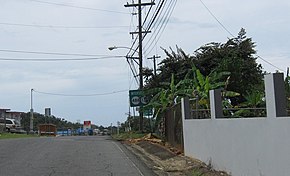
PR-487 near the interchange with PR-130 and PR-488
The entire route is located in Hatillo.
| Location | km[1] | mi | Destinations | Notes | |
|---|---|---|---|---|---|
| Bayaney | 8.7 | 5.4 | Southern terminus of PR-487 | ||
| Buena Vista–Naranjito line | 0.0 | 0.0 | Northern terminus of PR-487 | ||
| 1.000 mi = 1.609 km; 1.000 km = 0.621 mi | |||||
See also
References
- Google (3 August 2020). "PR-487" (Map). Google Maps. Google. Retrieved 3 August 2020.
- "Hatillo, Memoria Núm. 63" (PDF). Puerto Rico Planning Board (in Spanish). 1954. Retrieved 3 August 2020.
- "Puerto Rico" (Map). National Geographic Adventure Map. 2011. ISBN 978-1566955188. Book 3107.
- "PR-487, Hatillo, Puerto Rico". geoview.info. Retrieved 3 August 2020.
- "Tránsito Promedio Diario (AADT)". Transit Data (Datos de Tránsito) (in Spanish). Puerto Rico Department of Transportation and Public Works. p. 113. Retrieved 3 August 2020.
This article is issued from Wikipedia. The text is licensed under Creative Commons - Attribution - Sharealike. Additional terms may apply for the media files.