Culpepper Island
Culpepper Island is a tiny rock (island) in the Atlantic Ocean close to Bayfield and Ragged Point in Saint Philip, Barbados. The island is uninhabited.
 Culpepper Island Tiny Culpepper Island is just 30 m away from Barbados. 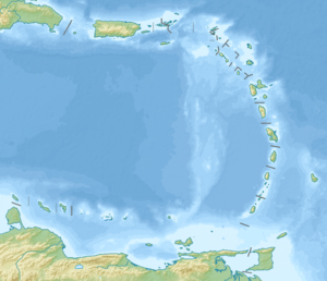 Culpepper Island Culpepper Island (Lesser Antilles)  Culpepper Island Culpepper Island (Caribbean) | |
| Geography | |
|---|---|
| Location | Caribbean |
| Coordinates | 13°09′57″N 59°26′36″W |
| Length | 40 m (130 ft) |
| Width | 50 m (160 ft) |
| Highest elevation | 18 m (59 ft) |
| Administration | |
| Parish | Saint Philip, Barbados |
| Additional information | |
| Time zone |
|
Geography
It is quite possible to wade out to Culpepper Island from the mainland during low tide as it is only about 30 meters away, but discretion must be used, as Culpepper is on the turbulent Atlantic Ocean side of Barbados. Further, the rocky footing can also be dangerous to walk on. Visitors are well advised to bear in mind that the East Point Lighthouse at Ragged Point was built to save ships from the dangers of this same turbulent coastline and Cobblers Reef.

Flora and fauna
Culpepper island is sparsely overgrown and uninhabited. It was claimed that peasants from Barbados once carried sheep to graze on the island, but this claim seems uncredible because neither the small size nor the very sparse vegetation makes the island attractive for this purpose.
History
The name of the island goes back to a settlers family name who reside here from about 1650 to 1830. Historically island was attributed to Barbados Saint Philip Parish.
On 12 March 2006 members of the region's indigenous Lokono-Arawak and Karifuna-Carib tribes attempted to make a claim on Culpepper Island to be their own. They stated that they were descendants of Princess Marian, daughter of the last Hereditary Lokono-Arawak Chief Amorotahe Haubariria (Flying Harpy Eagle) of the Eagle Clan Lokono-Arawaks who is buried in the Westbury Cemetery in Barbados.[1]
See also
External links
| Wikivoyage has a travel guide for Cobblers Reef. |
- Ragged Point, St. Philip
- Culpepper Island
- Photo of Culpepper Island, By Jon Farmer